A sudden magnitude 4.9 earthquake struck near Indio on January 19, 2026, sending tremors through Southern California and affecting over 20 million people from deserts to coastal areas. The event, followed by more than 250 aftershocks, including a 4.2 magnitude jolt before dawn on January 21, prompted swift assessments and renewed focus on the region’s seismic vulnerabilities.
Ground Shakes Southern California
The quake hit at 5:56 p.m., with its epicenter 12 miles northeast of Indio, along the Mission Creek strand of the San Andreas Fault. At a shallow depth of 1.9 to 3.1 kilometers, it amplified shaking across the Coachella Valley and beyond. Over 8,000 people reported feeling the ground move to the U.S. Geological Survey. Initial alerts pegged the magnitude at 5.1, then revised it to 4.6 before settling at 4.9 as more data arrived—a standard process in seismic monitoring.
ShakeAlert systems detected the event in 5.9 seconds, providing some residents with up to six seconds of warning. Those farther from the epicenter, like people in Palm Springs 37 kilometers away or Niland 67 kilometers distant, received timely notifications. Near the source, however, shaking arrived almost instantly.
Aftershocks Intensify the Swarm
Aftershocks began within the first hour, with four reaching magnitude 3.0 or higher by 7 p.m., the strongest at 3.4. By 6:30 p.m., 17 had occurred, mostly brief sideways shifts from strike-slip fault motion. The tally climbed rapidly: over 250 by January 20, including 11 at magnitude 3.0 or above, ranging from 0.8 to 4.3. Tremors extended to Borrego Springs, Joshua Tree, and Indio Hills.
A notable 4.2 magnitude event struck at 12:30 a.m. on January 21, 12 miles north-northeast of Indio Hills at 2.6 miles deep, felt by about 1,400 people. A 2.5 followed 30 minutes later. By January 22, more than 440 aftershocks had been recorded, with forecasts predicting a 97 percent chance of at least one magnitude 3 or higher through January 29, a 34 percent chance of magnitude 4 or above, and a 4 percent chance of magnitude 5 or larger.
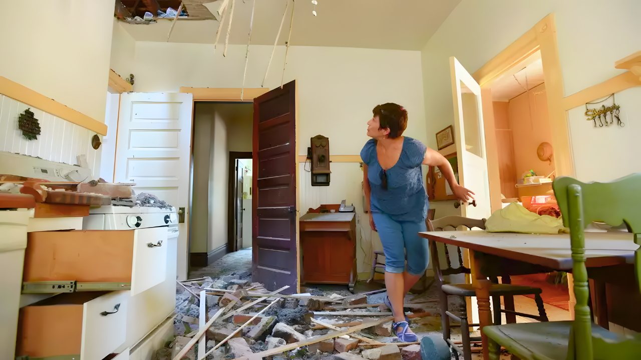
Damage Assessments Show Resilience
Preliminary surveys across the Coachella Valley and Inland Empire found no serious injuries, structural damage, or utility disruptions. Palm Springs police reported no damage incidents. Shaking reached Modified Mercalli Intensity Level VI near the epicenter—enough to topple shelves—but modern building codes limited impacts. The shallow depth concentrated energy at the surface, and basin sediments in areas like Coachella Valley amplified waves, creating sharp sideways jolts.
Scientists mapped the activity using dense regional networks, pinpointing ruptures on north-trending faults near, but not on, the main San Andreas line. Strongest effects hit Indio, Thousand Palms, Indian Wells, Twentynine Palms, and Palm Springs.
Seismic Risks and Historical Context
The San Andreas Fault stretches 750 miles from the Salton Sea to Cape Mendocino, separating the Pacific and North American plates. Its southern segment, with a 23-millimeter annual slip rate, last ruptured around 1680-1690 and could produce a magnitude 8.1 event. This swarm occurred about 10 kilometers from the main trace, beyond typical triggering distances of 6.2 miles.
USGS forecasts gave a 5 percent chance the 4.9 was a foreshock, 0.4 percent for magnitude 6.0 or higher, and 0.04 percent for 7.0 or above. Over 70 percent of California’s 40 million residents—more than 28 million—live within 30 miles of active faults. ShakeOut scenarios project a magnitude 7.8 on the southern San Andreas could cause 1,800 deaths, 5,000 injuries, and displace 500,000 to 1 million. In the next 30 years, Los Angeles faces a 60 percent chance of magnitude 6.7, 46 percent for 7.0, and 31 percent for 7.5; Bay Area odds are 72 percent, 51 percent, and 20 percent, respectively. Statewide, a magnitude 7 or larger is 99 percent likely.
The 1992 Joshua Tree magnitude 6.1 quake preceded the magnitude 7.3 Landers event, which ruptured 100 kilometers of fault, killed three, injured over 400, and triggered a magnitude 6.5 Big Bear quake with up to 5.5 meters of surface shift.
Preparedness Amid Ongoing Activity
Officials recommend Drop, Cover, and Hold On: drop to hands and knees, cover head and neck under sturdy furniture, and hold on until shaking stops. Avoid windows, walls, and heavy objects; outdoors, seek open areas; in vehicles, pull over safely. Falling objects cause half of injuries, per Loma Prieta and Northridge studies.
Cal OES advises reviewing plans, stocking water, food, flashlights, batteries, first-aid kits, and medications; knowing gas shutoff procedures; and using apps like MyShake for alerts. Aftershocks are expected to decline but could spike temporarily with larger events.
This sequence caused no major harm but underscores California’s restless geology. With faults overdue for major ruptures—like the 1906 San Francisco magnitude 7.9 and 1857 Fort Tejon magnitude 7.9—residents remain vigilant, as the next swarm could signal greater activity.
Sources:
Southern California Hit by a Swarm of Earthquakes in a Single Day Starting Near Indio. EDHAT, January 20, 2026
4.9 mag earthquake in southern CA followed by over 250 aftershocks, 98% chance of more. KMPH, January 21, 2026
4.2 magnitude earthquake strikes near Indio overnight. KESQ News, January 21, 2026
Series of aftershocks rattle Inland Empire after 4.9 earthquake in Indio area. Seismologist Dr. Lucy Jones weighs in. ABC7, January 21, 2026
U.S. Geological Survey (USGS). The Modified Mercalli Intensity Scale, January 23, 2026
ShakeAlert. ShakeAlert Because seconds matter, January 23, 2026