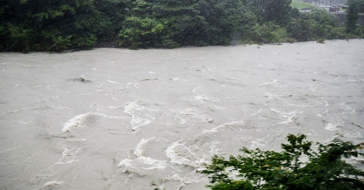
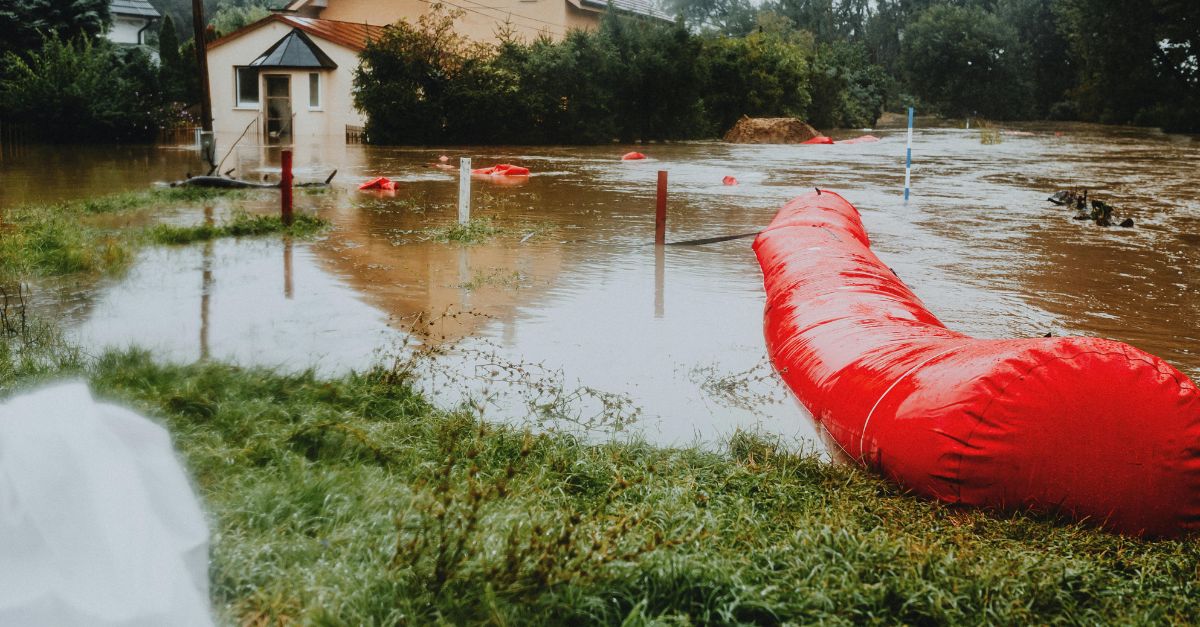
Western Washington’s rivers swelled to levels unseen in decades. On Tuesday evening, December 9, 2025, a second atmospheric river battered the Pacific Northwest after days of relentless rain.
Skagit County officials warned that the Skagit River would crest at 47 feet in Concrete and 41 feet in Mount Vernon—both several feet above prior records.
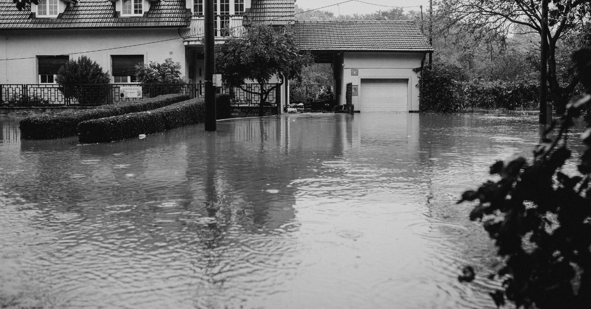
Levees risked overtopping. Communities rushed to evacuate. Governor Bob Ferguson is prepared to declare a statewide emergency. But warnings had been mounting for days.
The Second Wave
Monday’s atmospheric river triggered rescues and road chaos. Tuesday night’s second wave proved far more destructive.
Meteorologist Harrison Rademacher from the National Weather Service described it as a moisture jet stretching across the Pacific Ocean, pushing directly toward Oregon and Washington. A warming climate makes these storms more intense.
Rainfall exceeded 3 inches in the lowlands, with over 10 inches in the Cascades. Saturated soil, rapid snowmelt from 7,000-foot elevations, and pressure on aging levees created a catastrophic perfect storm.
Historic Benchmarks
The 1990 flood—the last major one—killed two people, displaced over 2,000 residents, and caused more than $100 million in damage. The Skagit River peaked at approximately 40 feet at Concrete that year. In 2003, it reached a level roughly the same as in 1993.
This week, forecasters predicted 47 feet—exceeding both by 5 feet. Upriver in Concrete, the river would break records. Downriver in Mount Vernon, 35,000 residents live in floodplain areas. Mayor Peter Donovan warned of a worst-case scenario unfolding.
A Cascade of Closures
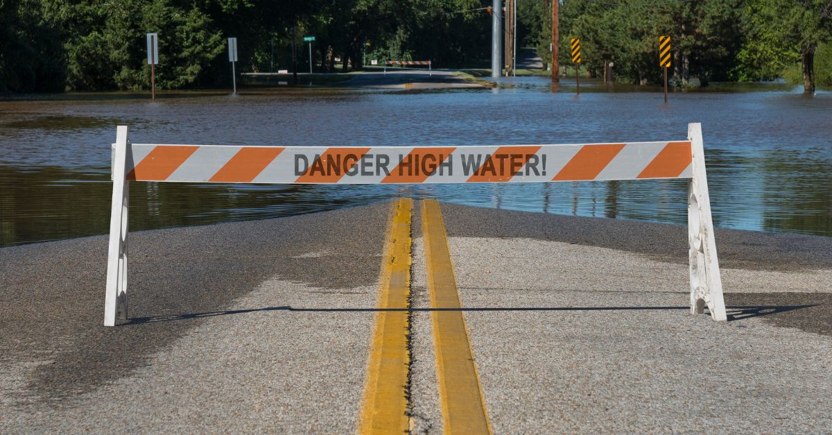
Transportation networks collapsed before the peak arrived. Interstate 5 near Napavine is closed due to standing floodwater.
State Route 202/203 near Fall City and Carnation shut down as the Snoqualmie River climbed. Eastbound I-90 near North Bend became impassable. State Route 106 in Mason County was closed after mudslides. Emergency responders redirected traffic. Residents received evacuation alerts.
The Washington Department of Transportation activated real-time travel updates. School districts delayed openings. Commuters faced stranded vehicles, disrupted supply chains, and cut-off emergency services.
Evacuation Orders and Broader Impact

State officials ordered immediate evacuation of approximately 75,000 residents in Skagit County, with up to 100,000 facing evacuation across multiple counties.
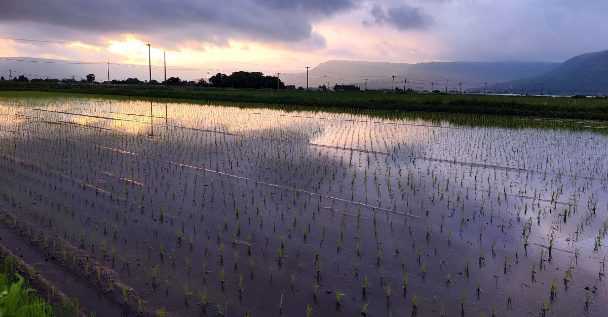
Beyond direct evacuations, the flooding threatened the Skagit River valley’s agricultural heartland—producing 95 percent of Washington’s red potatoes and 50 percent of the world’s beet and spinach seed—and risked disrupting port facilities and distribution networks across the Puget Sound region.
When accounting for residents dependent on disrupted agriculture, transportation corridors, and utility systems across these interconnected networks, the affected population approached half a million.
Orting’s Silent Warning
Orting, a town of 8,000 residents in Pierce County, faced an existential threat. The Puyallup River and Carbon River converged nearby, with levels matching the highest on record. Central Pierce Fire & Rescue issued “go-now” evacuation orders for neighborhoods along Williams Boulevard Northwest, Mellinger Avenue Northwest, and Stone Street Northwest.
Two police officers went door-to-door ensuring compliance. Mayor Josh Penner noted: “This matches our highest river level ever.” Fifteen years of flood control improvements helped. Families packed vehicles and sought shelter at the Multi-Purpose Center.
Boats in the Night
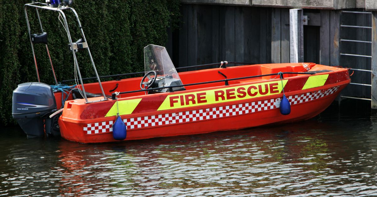
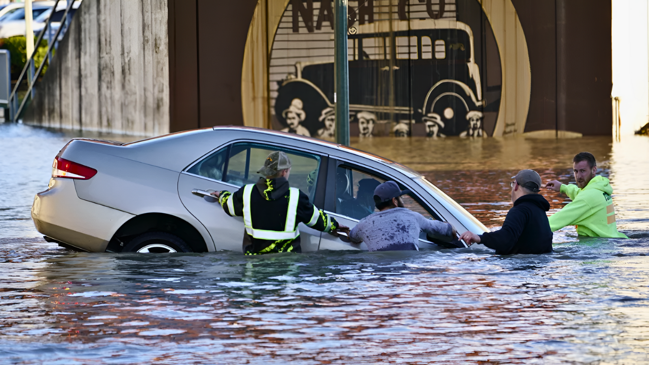
Monday night, December 8, rescue crews mobilized. Two campers near the Skykomish River between Startup and Gold Bar called 911 as floodwaters surged around their tent. Snohomish County Fire District 5 deployed drones with GPS, then sent a boat and hovercraft to rescue them.
Hours later, rescuers found another man stranded by rising water. A drone located him; a hovercraft brought him to safety. Tuesday morning, multiple cars became stuck on flooded roads. One woman climbed into her vehicle on Ben Howard Road. Fire crews rescued her by boat.
A Broken Levee Equation
The Skagit and Snohomish river systems operate as a regional hydraulic network. Skagit County officials warned that levees risked overtopping. The Arlington flood wall became a potential breach point. Concrete-area levees faced flagging.
Multiple counties activated National Guard units: 100 by Wednesday, 300 by Thursday. State officials coordinated with FEMA Region 10, the Army Corps of Engineers, and tribal governments. Federal resources depended on Governor Ferguson’s emergency declaration. In June 2024, the administration had denied Washington’s disaster aid request for prior weather damage.
The Climate Amplifier

Meteorologists warned of an uncomfortable truth: warming oceans and atmosphere intensify atmospheric rivers. Logan Howard of the National Weather Service reported temperatures 5 to 25 degrees above normal—conditions “rare or nearly impossible at this time of year without climate change’s impact.”
Warmer air holds more moisture; warmer oceans accelerate evaporation. These storms no longer remain outliers; they become baseline events. Researcher Winkley observed: “Heat-trapping pollutants make normal atmospheric river rain events significantly more troublesome or damaging.”
Washington, battling three drought years, desperately needed rain—but not like this.
The Water Danger Unspoken
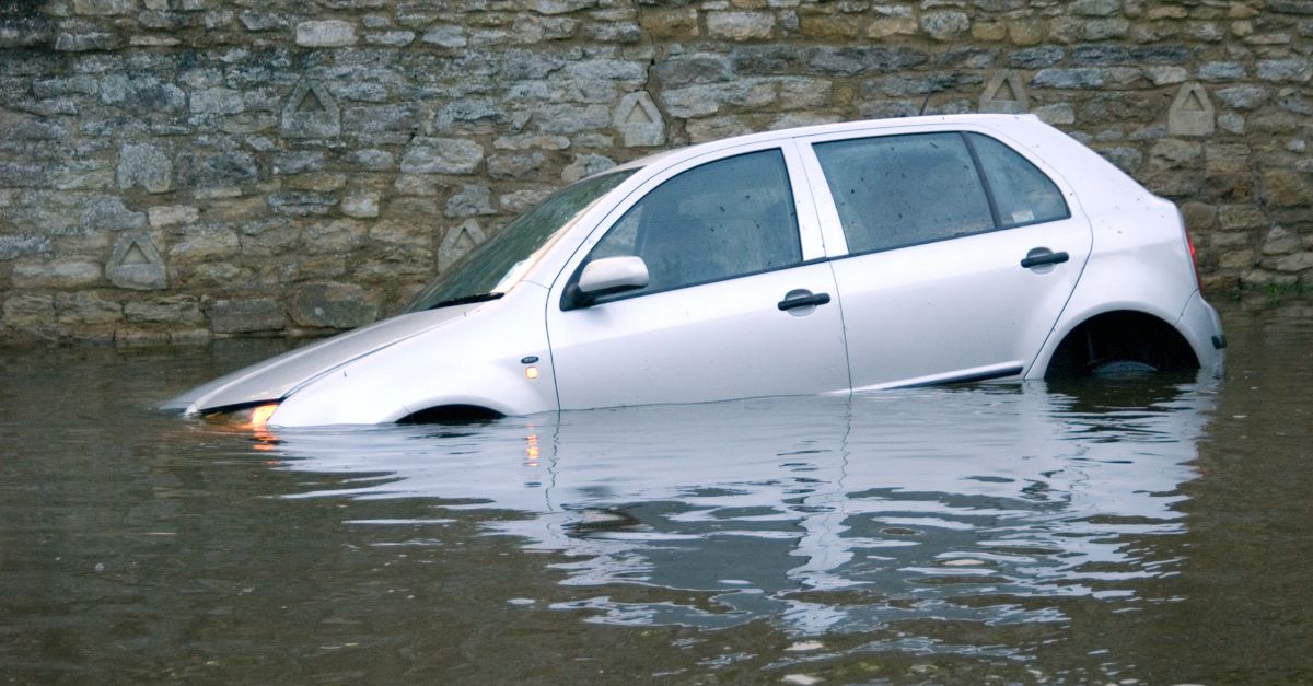
While headlines focused on evacuation numbers and record crests, emergency responders issued a critical quiet warning. Central Pierce Fire & Rescue posted water safety guidance: “6 inches of fast-moving water knocks over an adult. 12 inches can carry away most cars. 2 feet sweeps away a pickup truck.” Multiple residents ignored flooded roads and required rescue.
Authorities repeatedly urged: “Turn around, don’t drown.” The flood itself posed danger. So did human error and overconfidence. Vehicles became traps. Poor judgment caused fatalities. This secondary danger would shape recovery and post-flood investigations.
A Governor’s Gamble

Governor Bob Ferguson declared a statewide emergency on December 10, taking into account the calculated political risk. “Lives will be at stake in the coming days,” he said from the State Emergency Operations Center at Camp Murray. “We need the federal government’s help.” He requested an expedited federal emergency declaration for protective measures and resources.
But history loomed: in June 2024, the administration denied Washington’s major-disaster aid request after a bomb cyclone. Federal funds remained uncertain. General Gent Welsh of the National Guard warned: “Communities face serious challenges within 24 to 48 hours.” The state activated immediately.
The Levee Integrity Question

As water levels climbed toward record forecasts, an uncomfortable question emerged: were aging levees equipped for this? The Army Corps of Engineers and county public works departments conducted rapid inspections. The Arlington flood wall risked overtopping. Concrete-area levees became flagged. Engineers warned that levee failures would not occur uniformly.
A single breach upstream of Mount Vernon could route water across thousands of acres, inundating floodplain properties and critical infrastructure. State officials called this a “worst-case scenario.” It remained hypothetical—but barely. Without early warning and rapid evacuation, property damage could reach hundreds of millions of dollars.
Supply Chain Fractures
The flooding disrupted regional supply chains, extending beyond personal evacuations. Agricultural areas in the Skagit River valley—a major vegetable-growing region—faced inundation. Ports and distribution centers in King and Pierce counties risked service interruptions. Utility companies warned of possible power outages if transformer stations are flooded.
Water treatment facilities operated on emergency protocols. Hospitals activated disaster plans. Economic damage extended beyond property loss. Operational paralysis threatened the region. Economists estimated that the cascading impacts could reach tens to hundreds of millions of dollars, depending on the levee’s performance and peak water levels.
The Forecast Uncertainty

Wednesday night, meteorologists hedged their language. The National Weather Service extended the Flood Watch through Friday, warning that lingering showers would prolong the flooding threat. River crests would peak on Thursday at Skagit Concrete and on Friday at Mount Vernon. However, weather models diverged based on minor variations in rainfall.
If precipitation fell heavily in the upper Cascades, snowmelt could surge, resulting in peak flows that are 10-15 percent higher. If rain stayed lighter, crests might stay below record forecasts. This uncertainty—a range of a few feet—separated manageable flooding from catastrophic levee breaches. State officials prepared for the worst while privately hoping for better.
A Question for the Region

As families evacuated, engineers inspected levees, and rescue crews staged at river crossings, a deeper question lingered: How does a region prepare for a new normal? The 1990 and 2003 floods set the historical baseline for infrastructure design and emergency response.
But 2025’s forecast exceeded both. If warming climate trends hold—more intense atmospheric rivers, higher rain lines, warmer baseline temperatures—will 47-foot crests become standard within a decade?
Skagit County and King County planners face a reckoning: invest in levee upgrades, managed retreat from floodplains, or accept escalating disaster cycles? What comes next—adaptation or denial?
Sources:
Seattle Times, 10 Dec 2025
Climate Research, Atmospheric River Projections
National Weather Service Seattle, Flood Watch
News Channel 5, 10 Dec 2025
KUOW, 9 Dec 2025
Washington Examiner, 9 Dec 2025